Text by Jack Yeazel (20 May 2006 / 6 Dec. 2008)
Return to GPS General Information Home Page
Offshore Navigator Lite does real-time tracking but does not support recorded tracks and other features. If you want more features you can get Offshore Navigator which sells for around $100.
With the DVD and software installed on a computer you can create GPS routes by clicking the mouse. Each click puts a waypoint on a chart. Click again and you create a route.
Chart segments and route plans can be printed on standard printers. And if you have a computer onboard, connect a GPS and you'll see your vessels location on the detailed charts for real-time tracking and positioning.
U.S. Boating Charts are arranged in 23 Chart Kits making it easy to find specific charts for your favorite boating and fishing areas. See (HERE) for a list of the Regions. The DVD includes all of these Regions.
Offshore Navigator
Lite, Main Screen "World Chart"
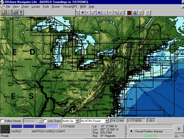
After clicking on an area of interest of the World Chart, clicking
on the dark blue boxes will select
charts with successively larger scales (and cause the box to turn
light).
World Chart Screen Zoomed
In
1:216,00 Chart Locator Index
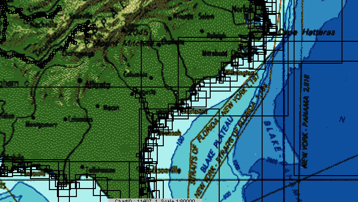
Clicking on the chart outlines above, highlights them in light green,
and reveals the chart name of interest (below).
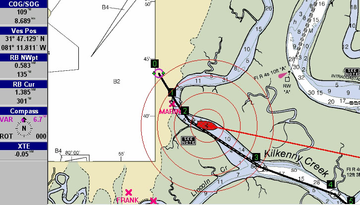
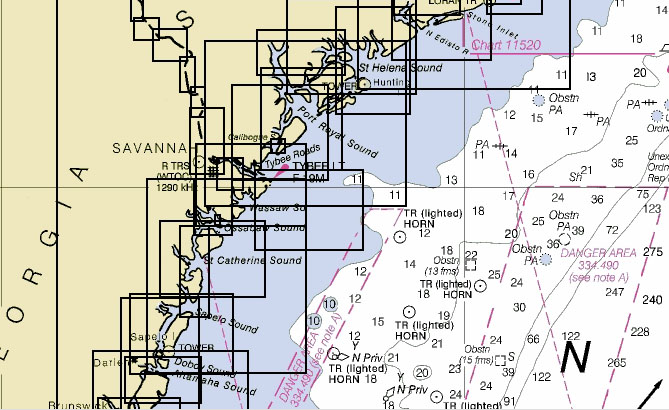
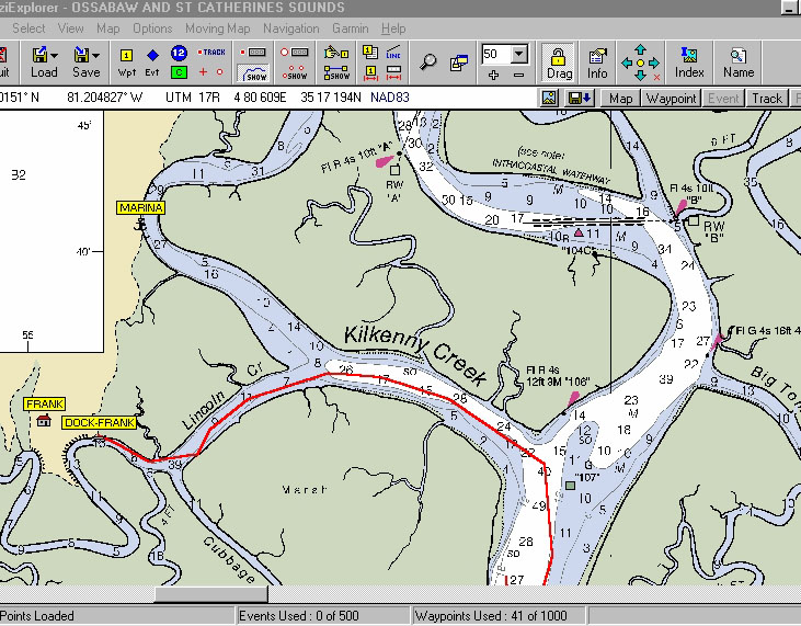
"11511_1" (OSSABAW AND ST. CATHERINES SOUNDS) 1:40,000 Chart
On this chart, a vessel has been simulated to be traveling along a Route (created by clicking on the desired routepoints, 1, 2, 3, 4, and 5). Its COG (Course Over Ground) is 109° with a speed of 8.689 kts. The XTE (Cross Track Error) is -0.05nm (to the left of course). The RB NWpt (Relative Bearing to the Next Waypoint is 135°. Thus the ship needs to turn to about 155° to intercept the current leg of the Route. As the above screen shows, the program will track the ship in real time on the chart.
Waypoints "MARINA" and "FRANK" (downloaded from a GPS) are each identified by a large red "X". The red Range Circles have been selected to predict the position the ship in one minute intervals, thus as the ship speeds up, they increase in size. Fixed distance range circles can also be selected. The dashed courseline is the current one and changes as the ship passes each waypoint.
GPS SUPPORT:
The program supports ten different GPS manufactures including Garmin,
Lowrance, and Magellan hand-helds, plus Brunton, Furuno, Northstar, Raymarine,
Standard Horizon, and Trimble. For position tracking, it also supports
generic NMEA.
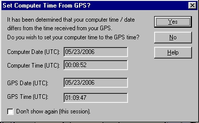
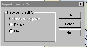
To download GPS waypoints or routes, first select the desired GPS, port, and baud from Vessel/GPS, Setup, GPS. Then from File, Import Data fromGPS. One can then set Computer time to GPS time. Select Routes or Marks. A list of waypoints (Marks) will be shown, but one has to Select and Receive the ones to be shown on the maps.
 .....
.....
Using Ozi Explorer with the Maptech U.S. Boating Charts to Show Recorded Tracks
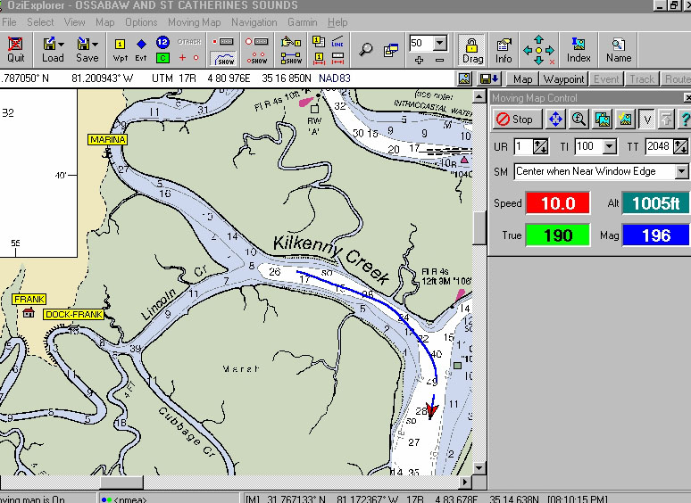
Ozi Displaying a Previously Recorded GPS Track Downloaded
in Red
CONCLUSION:
For a mere $50, with Maptech's U.S. Boating Charts on DVD, you can
have a collection of US digital (and GPS-compatible) marine charts that
in the past would have cost hundreds (maybe thousands) of dollars.
The program even recognized the lowly Garmin GPS 12XL (used to simulate
the moving ship in this review).